가격과 성능에 대한 새로운 기준 제시
듀얼 GNSS RTK 수신기와 소형 MEMS IMU를 결합하여 센티미터 수준의 위치 및 모션 데이터 실시간 제공
새로운 Multi-Core IMU 기술은 작은 크기 및 가격 대비 강력한 네비게이션 성능 제공
고성능 네비게이션
GNSS(GPS, GLONASS, Galileo, and Beidou) 지원을 받아 RTK GNSS 수신기에 2개의 인공위성 및 주파수 사용
OxTS gx/ix™ tight-coupling 기술은 GNSS가 중단될 때 RTK가 없는 시간을 최소화 하고 주변에 시야가 확보된 인공위성들을 함께 사용하여 정확한 네비게이션 솔루션을 제공
OxTS gx/ix™ tight-coupling 기술은 GNSS가 중단될 때 RTK가 없는 시간을 최소화 하고 주변에 시야가 확보된 인공위성들을 함께 사용하여 정확한 네비게이션 솔루션을 제공
간편한 설정
다음을 통해 AV200을 빠르고 쉽게 세팅할 수 있습니다.
– 이더넷 및 CAN 통신 데이터 인터페이스
– 시간 동기화 및 PTP 지원을 위한 디지털 PPS
– 데이터 디코딩이 가능한 ROS 2 드라이버
– 맞춤형 인터페이스나 인코딩 없이 외부 센서를 내비게이션 솔루션에 통합하는 보조 인터페이스
– 이더넷 및 CAN 통신 데이터 인터페이스
– 시간 동기화 및 PTP 지원을 위한 디지털 PPS
– 데이터 디코딩이 가능한 ROS 2 드라이버
– 맞춤형 인터페이스나 인코딩 없이 외부 센서를 내비게이션 솔루션에 통합하는 보조 인터페이스
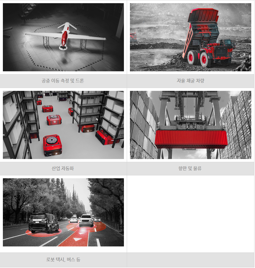
| 자율주행 주행 시 정확한 위치 파악을 위한 GNSS+IMU 결합 | |
| 가격 대비 성능이 뛰어난 IMU 디자인 및 최첨단 센서 | |
| 업계에서 입증된 Kalman 필터 및 네비게이션 엔진 | |
| 경로 설계 및 제어를 위한 강력한 Lane-level 포지셔닝과 동적 출력 | |
|
GNSS 신호가 끊기는 환경에도 부드럽게 연속적 데이터 출력 |
|
| 듀얼 안테나로 정지 상태 및 Low dynamic 상태에도 정확한 방향 제공 | |
| ROS2 드라이버 지원 |
| Model | AV200 |
|---|---|
| GNSS constellations |
GPS L1, L2 PPP |
| Position accuracy |
1.5 m SPS |
| Velocity accuracy |
0.2 km/h |
| Roll/Pitch accuracy | 0.1° |
| Heading accuracy | 0.2° |
| Measurement rate | 100 Hz |
| Operating temperature | -40°C to +70°C |
| Specification temperature | -20°C to +70°C |
| Power input | 5-30 V dc |
| Power consumption | 4 W |
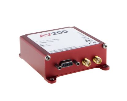
| Dimensions | 77 x 63 x 24 mm |
| Weight | 130 g |
| Logging capacity | 32 GB |
| Interfaces | Ethernet, CAN |
| Dual antenna | Yes |
| PTP capable | Yes |
